Weather forecast included about 112% chance of precipitation and a trend of cooler temperatures. Rather than spend my time driving east to find potential sunshine, Sumas Mountain lured me northward with the promise of snow instead of rain and a tantalizing scavenger hunt for missing mines #2 and #3.
Some of you may vaguely recall a Sumas Mountain trip report from April where I enjoyed a full day with two well known local geologists. That trip report included locating Mine #1, the infamous Sumas Safe, the Sumas Mountain Outpost and the 'Sumas Mountain Summit Register' that honestly is no where near the summit and is closer to dangling from a soggy cord off a cliff face. Yep, that was an interesting day and you can read all about it over here.
This second visit to Sumas Mountain involved a clockwise rotation (whereas the first trip was counter clockwise).
The clockwise rotation gave me a chance to first visit the cabin to gander at the not-to-scale map mounted on the cabin wall. This map indicated that Mines #2 and #3 are both upstream from Mine #1.
Hardin Creek or Rankin Creek... not really sure.
Long story short... Mine #2 and #3 are upstream from #1 and are both accessible to those with determination.
The trail is steep and soft. Some parts of the trail have sluffed off down the hill... that's how steep and soft it is. It's highly recommended that you go slow, proceed with caution, bring (and use) poles and keep in mind the huge 'slow landslide' that is just a couple valleys to the south of you.
Mine #2 is easy to enter from the trail. Since I was solo, I only ventured in far enough to take the posted photos.
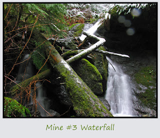
Mine #3 is much more tricky. Descent is a risky route of veggie belays or your ability to trust a thin, old, elastic rope (twine may be a better description) to keep you stable as you descend to the creek. Once down to the creek, you'll need to cross it because Mine #3 is on the opposite side.
To reach the Mine #3 shaft you'll have to either yank yourself up using a rope anchored to a rock that appears to be holding up the mine roof. I wasn't brave enough to stand under the entrance and pull on the rope that would pull on the rock.
The other option is to 'belly crawl' your way up a slippery tree trunk that someone has placed against the slick rock wall. Considering the wet conditions of the day (and the fact that I was all alone out here), I opted to leave skip that option too.
The third potential option is to go downstream about 20 feet and attempt to climb up a steep incline of soft duff to get above the mine, then switchback your way down to the mine entrance... all the way on a steep incline of soft duff. A misplaced step or loss of footing would send you sliding into the shallow creek... probably with a broken ankle or leg.
So... I didn't actually get to peer into Mine #3.
That's alright though. A third trip to Sumas Mountain is a necessity as I still desire to hike over to get a better view of the 'slow landslide'. Probably that will wait until we've had at least 10 consecutive DRY and HOT days.
Since the trail seems to end at Mine #3, I turned around and headed back to the main trail.
Once at the clearing, I set out to explore the Slow Landslide area, but concluded that I was too tired and too wet for any more adventures. So, it will wait for a future visit.
On the way out, a quick visit to Mine #1 and the Safe were interesting (and easy).
The weather forecast held true. It rained or snowed on me most of the day and it just so happened that my clothing hit its saturation point just as the car came into view.
The day ended with a quick jaunt over the border into Canada for some Peanut Free Chocolate and then hitting a number of stores in Bellingham, Burlington and Mount Vernon for Christmas shopping purposes before finally arriving at home.
What a day!
Route Map: 6.5 miles, 2,500 feet of net elevation gain. The two blue dots furthest to the east represent the #2 and #3 mines. Other dots indicate trail junctions, Mine #1 and the Safe.
Happy Hiking!
~E


No comments:
Post a Comment