The trouble with YAB, and the primary reason it took me so long to actually tackle this hike, is due to the late season access and the legendary rumors about the long, rough road to get there.
Really, the road isn't that bad to the trail head. It has a little more than its fair share of pot holes, big rocks and un-level tire tracks, but the majority of stock sedans can make it without too much trouble.

In the event that you are comfortable with such a drive and you find yourself looking for a fantastic hike on a sunny August, September or October day, then you should definitely give YAB a visit.
First helpful hint is that when you see the sign above, please take note of the white arrow. It means that the trail is further along the road. Park here and you are adding an extra half mile and 100 feet of elevation gain to your hike... before the hike even begins. Trust me. I know.
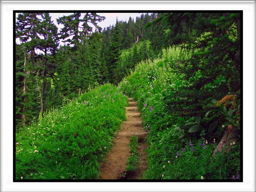
The trail starts off in the woods with a sweat inducing incline. It remains consistently steep until you break out into this meadow after about a mile or so. Shortly thereafter you'll reach a junction. Left toward YAB or continue upward to Gold Run Pass and/or beyond to Tomyhoi Lake.


The route to YAB flattens out a bit as it circumnavigates the head wall of the valley below Gold Run Pass. Indian Paintbrush flowers were blooming here as the trail passes below a cliff.

A number of snowfields linger in the valley virtually year round. Since this is my only visit, I can't say whether this particular snowfield (the largest of the few I crossed) will last through the summer and fall or not.
Poles or an ice axe would be prudent, but a slip and slide wouldn't deposit you too far away. Please use common sense and caution. You are a long way from medical care.

Rounding a corner and out of the valley you'll encounter a meadow, possibly flower filled, which is one of the slopes of YAB.


Views about in every direction. Having a good zoom on your camera is a wonderful tool to capture details of distant scenery for scrutiny one you've returned home safely. Here is a view of the trail to Mount Larrabee, with the Pleiades in the background. Imagine the view from THAT trail! It's now been added to my Bucket List.


Not quite a Conga Line, but YAB is really popular. The top of the below image is where the majority of hikers stop for lunch and declare it their 'turnaround point'.
Many of them don't realize that this is actually just a 'false summit' or more aptly, a 'false butte'. Sure it's a butte, but it isn't the "Yellow Aster Butte" that is labeled on the map. Those set on reaching the legitimate YAB will need to continue onward. I chose to turn around on the false butte, with plans to continue onward with my next visit.


One of the highlights of YAB are the variety of tarns down below the butte. It is rumored to be a fantastic location for camping (if you look closely you might be able to pinpoint at least two or three tents in the picture below). Flowers, sunsets and a few mining artifacts add to the wonder and beauty that makes this area so special.
To reach the tarns, hikers need to follow a trail down hill toward the tarns instead of heading uphill to the butte.
In the not too distant past the 'normal' route for reaching the tarns and YAB was to hike in along the "Keep Kool" trail. The "Keep Kool" trail begins at a much lower elevation than the current trail head. Many people continue to use the Keep Kool trail in the early season (or all year, actually) instead of waiting for the road to melt out. The old route, as I understand it, ascends through a lot more forest and lacks many of the views available on the 'new' trail. Also, it brings hikers to the tarns first instead of making them gain elevation and then lose it again.

Hikers that camp at the tarns or that just descent to visit the tarns have the option to ascend most of Tomyhoi Peak. The trail should take you most of the way to the top, but the true summit is reported to require ropes and rock climbing skills to physically reach the high point. Again, another route for me to consider on my next visit.

While it's hard to see without a telephoto, the Winchester Lookout can be seen from YAB (and the false YAB too). The below photo was with a full digital zoom, the photo below it was using a 10x optical zoom.
Note that the shutters are open and the flag is flying.
The Winchester Lookout is another fantastic hike. The lookout is maintained by the Mount Baker Club and lucky backpackers can sometimes find it unoccupied and enjoy an unforgettable night with the best views on earth.


Here is a view of the real YAB, as seen from the false YAB where many turn around. Reaching the real YAB will require some significant elevation loss before gaining the true high point.

My route for the day was about 9 miles and 2,500 feet of elevation gain. My Garmin 60Csx decided to freeze up half way up to the base of the Butte, so the image below is actually mapping my route back to the vehicle from my turn around point on the first YAB. You can clearly see the short deviation to a separate little knob and the short visit to Gold Run Pass for my glimpse of Tomyhoi Lake. There will be a separate post made shortly for Gold Run Pass.

I highly recommend the YAB trail for hikers who are in good physical condition and who don't mind heights or long bumpy dirt roads and elevation gain.
Happy Hiking!
~E
9/17/2012
ReplyDeleteAdded the 'missing' picture of the trail up toward Tomyhoi Peak.