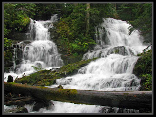
Mid-October can be a fantastic time to visit Lake 22 (or Lake Twenty Two or Lake Twenty-Two, but not Lake 23). Fall colors can be plentiful around the lake and the waterfalls are sure to be roaring.
Lake 22 is a similar hike to it's neighbor, Heather (Lake), but 22 is a little bit longer, a little bit higher, a little bit larger (circumference) and a lot better in the trail condition and overall 'bang for your waypoint' than Heather.
This neck of the woods tends to get more than its fair share of rain. Our hike was no exception. It started in a downpour which eventually tapered off after less than a mile (but then it came back in fits and spurts throughout the day).
The trail starts off with a mellow incline until it crosses a bridge with a sizable waterfall. Immediately therafter the grade increases, but there are at least three or four waterfalls to look forward to.
Eventually the trail enters a clearing where the route will switchback once or twice as you gain elevation before re-entering the woods (and a final waterfall) before your sudden arrival at the lake. The trail continues all the way around the lake, with a few campsites under the cover of trees off to the right (counter clockwise).
The lake itself sits in a large cirque at the base of Mount Pilchuck. During winter (and spring and most of summer) the lake is mostly frozen and avalanches come down the cirque walls at the far side of the lake. As seen below, snow (and ice caves) commonly remain through the summer. Be smart... do not enter the ice caves. Rescue teams are hours away.
People are known to snowshoe along the trail to the lake, but please be aware of the avalanche dangers involved -- seen and unseen -- they can and do happen along the main route, and people have lost their lives as a result. Just because you 'can' get there on snowshoes doesn't mean you 'should' be there. I'd recommend snowshoeing somewhere else and doing this hike in the fall, before the avalanche risks develop.
In the talus field at the far end of the lake, don't be surprised to find Pika's acting cute, hoping you'll take a photo and turn them into the latest internet sensation.
The trail to Lake Twenty Two starts right off the Mountain Loop Highway a short distance east of the Verlot Ranger Station. The parking lot is rather large, but on nice weekends in the summer it fills up fast.
Here are a couple videos. Once contains a panorama taken from the lake, and the other is just a lot of 'rapid fire' snapshots of waterfalls (and pika's).
Route Map: Approx. 1,700 feet of elevation gain and 7.5 miles round trip (including the lake loop).
Happy Hiking!
~E
Saturday, November 24, 2012
Friday, November 9, 2012
Itinerary for 11/10/2012
Planning to hike with a group of friends to Annette Lake off I-90 between North Bend and Snoqualmie Pass.
Departing North Bend @ 9:15.
See you there!
~E
Departing North Bend @ 9:15.
See you there!
~E
Saturday, November 3, 2012
Mt. Pilchuck 10-15-2012
I'll try to keep this short and sweet since it's a bit outdated.
Outdated in that the hike was a few weeks ago and shortly afterwards Mother Nature dropped a coat of Winter on the mountain which means the conditions portrayed in the photos won't be seen again for another 11 months or so.
It was a great hike. Weather forecast was sketchy, but the rain held off entirely until 10 minutes into the drive home.
The lookout was open (but no views) and it was howling windy up there.
Only three other people on the mountain that day. Solitude + Pilchuck = Awesomeness!
Video at the bottom of the post.
Can you see the frowning face on the top of that block of Granite? Fascinating.
Details:
Mt. Pilchuck is located just beyond Verlot on the Mountain Loop Highway. From I-5 north of Everett head to Marysville and then east to Granite Falls. From Granite Falls, follow the Mountain Loop Highway toward Darrington. The Mt. Pilchuck road is on the right side just after passing the Verlot Ranger Station and crossing the bridge over the river. Follow the Mt. Pilchuck road to the trailhead located at the end of the road.
During winter the road is often gated at the Heather Lake trailhead.
Northwest Forest Pass required for parking.
Happy Hiking!
One more trip report is coming... hopefully in the next week or so.
Subscribe to:
Comments (Atom)


