Friday, August 30, 2013

Ragnar Relay Recap - Northwest Passage - 2013

What is "Ragnar"?

Ragnar was a king and hero of early 9th century Scandinavia. He was a conqueror, a wild man, a leader, fearless and free-spirited (possibly a romanticized version of history that may or may not be based on facts).

A Ragnar Relay was named after so when the Ragnar Relay founders decided to include a long uphill route that gained more than 4,000 feet of elevation.  Who on earth would want to run such a thing?  Ragnar would!

Instead of catering to ultra-runners and those who have dedicated their life and hours each day to serious, competitive running, Ragnar Relays offer an epic opportunity for anyone (and their friends) to accomplish something amazing, together.

These are Ragnarians.

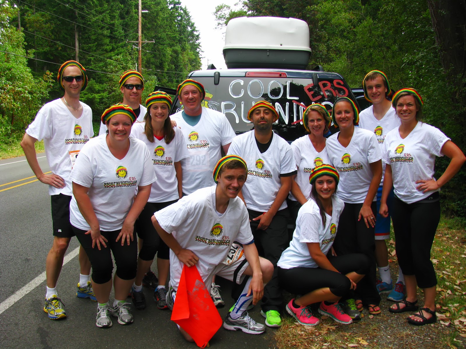
Ragnarians seek adventure, love fitness and the outdoors, give moral support to each other at 3 AM, enjoy camaraderie, don’t stop for bad weather, accomplish the amazing – together, aren’t afraid to wear crazy costumes, cheer others on, and ring cowbells to celebrate victories – small and large

Ragnarians fulfill their freedom to roam, to explore, to lead, – a free-spirited desire to get out there and experience an outdoor adventure with friends. They traverse beautiful scenery, conquer challenges, and celebrate as a team. They outfit themselves in crazy costumes, deck out their vans and tents and walk away with kick-ass medals, bragging rights and unforgettable stories of this epic adventure!


Most of those last two paragraphs aren't my words - they are descriptions I mostly copied from the www.ragnarrelay.com website - but I did so because they hit the mark dead on.

The Northwest Passage 2013 Ragnar Relay was held on July 19th and 20th.

The course began at Peach Arch Park in Blaine, WA (the most popular US/Canada crossing in Washington) and continued southward through Birch Bay, Bellingham, Burlington, Mount Vernon, LaConner, Anacortes, across the Deception Pass bridge on to Whidbey Island, through Oak Harbor and Coupeville and ending in the little town of Langley.  196 miles.

Our team name was "Cool Runners".  11 of the 12 people on the team were related to each other... kind of a family reunion with relatives coming from Washington, Utah and Arizona.  They had a solid group of 11 but needed one more runner to fill the vacant spot.  Ragnarrelay.com helped get us connected and it was a perfect match!  They were thrilled to have me on their team and I was thrilled to be there!


Teams were assigned a starting time based on the estimated average pace of the entire team.  Training wasn't really a focus for this team as they were more interested in just enjoying the event and spending time together.  Accordingly, we had a slow average pace and ended up with a 6:45am starting time.  The slowest teams started at 6:00am and the fastest teams started much later in the day... like Noon, or 4pm.

Each team member is assigned a position, #1 thru #12.  Runners #1 thru #6 all ride in one van and runners #7 thru #12 ride in a second van.  I was runner #8, hanging out with the second van.

Each team member runs specified segments, in the assigned order.  Runner #1 would run Segments #1, #13 and #25.  Runner #2 would run segments #2, #14 and & 26. etc...

I ran segments #8, #20 & #32.


My first run (segment #8) started about 1:30pm or so, running from Fairhaven up to Lake Padden and then to the I-5 interchange at North Lake Samish.  Although this leg had the most elevation gain of all 36 segments, it was a great route!  My wife & kids and their friends were waiting for me at the lake to cheer me on and then my hiking buddy Tim (Oarboar!) Mahoney met me just out side the park to encourage me to keep up the pace... and he popped up again at the N. Lk Samish exchange where I handed off the wrist-baton to Colton (our runner #9).


After our last runner complete her segment at the Burlington High School, our van went to grab Subway sandwiches at the local Wal-mart before driving out to LaConnor to try and catch some sleep before our 2nd wave which we expected would start at about  11:15pm.


My second run began at about 12:15am and took me by the Swinomish Casino next to Hwy 20, across the Tommy Thompson Trestle in pitch black night, through a tree covered trail and into Anacortes.

After that, it got cold out and I was ready for some sleep.  Eventually we were dropped off at the Coupeville High School for a couple hours of sleep before beginning our last legs of the run which started about 10:30am.

After running faster, further and longer than he ever had before, our Runner #7 had to call in some backup help for the last mile and a half which involved a nasty & long hill.  I was glad to step in and help out (but I really should have made a pit stop first and had something more than nothing for breakfast).  I tried my best, by my tank was on empty and I ended up walking a couple short stretches despite my desire not to.


Word to the wise... even though you may not feel hungry, don't skip the chance to consume some calories before your third run!

My final run finished about 1:00pm on Saturday.  From then on out the focus was on aiding the team and encouraging them to hang in there to the finish line!

With 45 minutes to go we finally crossed the finish line and successfully collected our medals!

Although this blog post completely lacks the fun details... the costumes, the camaraderie and the thrill of the event I can honestly say this was one of those weekends that will forever be a memorable one.

I owe that to all my fellow Ragnarians.  I also owe it to my family for supporting my hours of dedicated training and the Cool Runners team for taking a chance on me.

With the fond memories of this epic adventure, I've compiled many of the meaningful images into a book on Blurb.com.  It's the images and the effort that I put into it that makes it a special and personal memento for me, and me alone.  You can buy one if you want to, but I'd rather have you join me for the 2014 relay instead.  :)

Fellow Ragnarians... if you would like some help in creating a similar book feel free to let me know and I'll help you out if you need it.  Or... if you are looking for a team or a teammate, feel free to call me, maybe.

I'll try to lay off the Ragnar posts for at least six months.

BRING ON THE HIKES!

~E

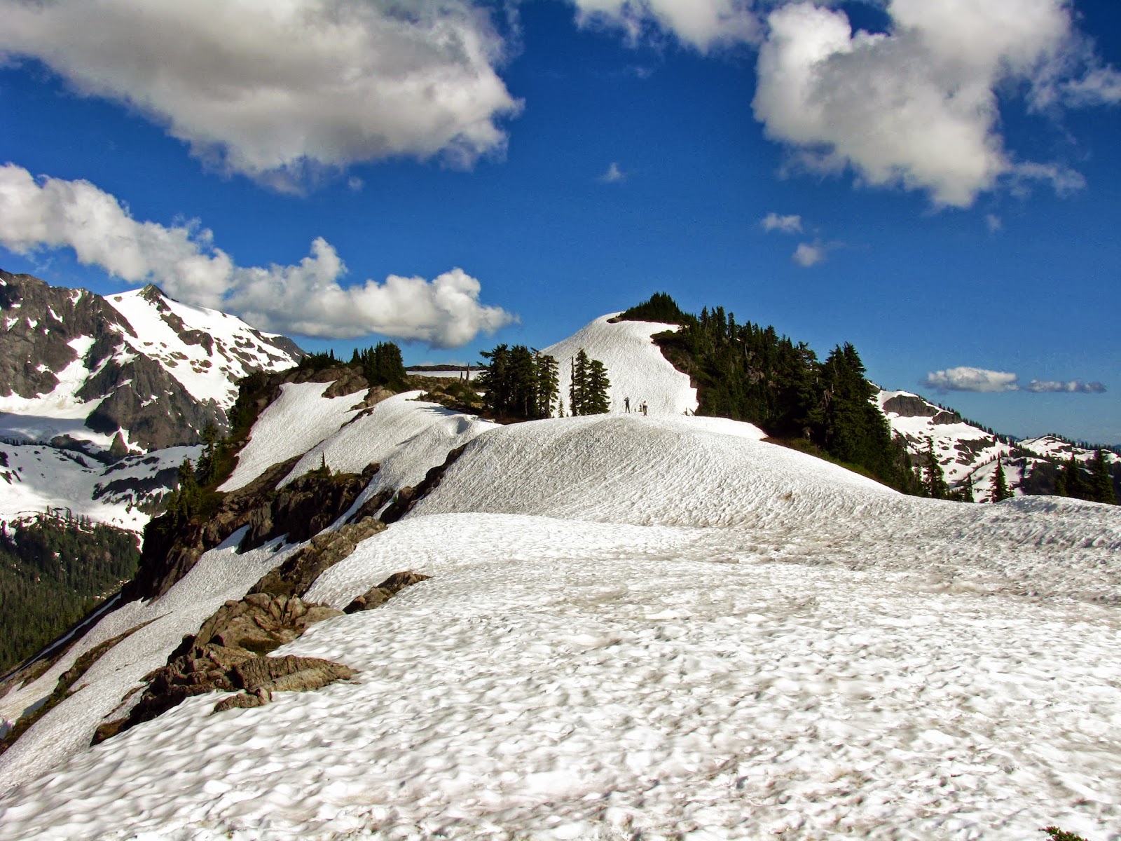
PS:  Coming soon:  A Trip Report to High Pass with epic photos!

Thursday, August 29, 2013

Thursday, August 22, 2013

Itinerary for 08-24-2013

Hiking the Lake Ozette Triangle! Woo Hoo!

Should be a few good sized trees out there for my hammock, ya think?

~E

Wednesday, August 21, 2013

Artist Point 07-13-2013

Artist Point is one of the most popular destinations in Whatcom County during the summer, unfortunately it's rather difficult to get there most of the year.

Artist Point is located at the very end of the Mount Baker Highway (Hwy 542), but generally speaking, the last two or three miles of road are buried by more than 10 feet of snow.  Each spring, the WA Dept. of Transportation folks set out to assess the snow depth and decide when (or IF) they will start to plow off the snow so vistors can safely drive to this panoramic vista and the popular hiking trails.

2013 provided a nice combination of lots of snow followed by lots of sunny weather which allowed a relatively early plowing of the road and thus, early access by car.

While the road allows easier access, it is always possible to hike or snowshoe to Artist Point from Heather Meadows (which is where the road plowing ends during winter, also known as the Mt. Baker Ski Area).

With an earlier than expected opening, and a lagging hiking mojo due to a rigorous running schedule, but a schedule-free and sunny day in front of me, I extended an invitation to Alexia to see if she was interested in going for a hike.  She was up for the challenge!  Even better... she wanted to bring her dog.


We made a stop in Maple Falls for some hiking/lunch snacks and then drove right up to Artist Point where I discovered my Northwest Forest Pass expired in June.  It was also upon our arrival that we realized the road may be clear, but the hiking trails were all buried.


Despite having a gps which had been previously programed with all the local trails (for just such an occassion as this), our hiking efforts would be minimal since the bigger issue was simply one of 'traction' and 'keeping snow out of your shoes' and 'do not lose the dog'.


Accordingly, we were content with exploring the ridges with mostly safe run-outs in case of an accidental slip.


Our wanderings led us about halfway to Huntoon Point where we enjoyed a lunch break.


Next stop was an exploration of the massive amounts of snow that continue to cover the entire bathroom building.


Finally, we converted a plastic-wrapped piece of cardboard which used to serve as a home for a case of bottled water into a sled.  We put this to good use beneath Table Mountain where there were already two sledding chutes just waiting for us to risk our tailbones on.


The weather was warm and the bugs were minimal.  There were quite a few people up there, but still plenty of parking.


We had a great time up there and made it back home completely refreshed instead of exhausted!

Here is a video with some additional photos but also some sledding footage.

Hiking and impromptu sledding at Artist Point 07-13-13 from Eric Rolfs on Vimeo.


Happy Hiking!


Monday, August 19, 2013

Great run at Whatcom Falls Park tonight!


It's too bad my phone takes such awful pics.

Trust me, the run wasn't all that great, but the trails are spectacular!

~E

Saturday, August 17, 2013

Sunday Morning Hike?

Might head to Mt. Baker's Railroad Grade trail in the morning for a quick out-and-back outing.

Anyone interested at this late date?

Potentially leaving @ 8:30a.m.  Home at a reasonable time... oh, wait... my Forest Pass is expired.  Hmmm... guess I'll deal with that in the morning.

~E

Tuesday, August 13, 2013

Grand Trunk Hammock Review 08-11-2013

This blog post is dedicated to the fine folks at Grand Trunk Goods for adding a whole new dimension to my day hikes!  As I've discovered, hammocks are convenient, compact, comfortable and surprisingly easy to set up.  My gear closet now has a Grand Trunk Double Hammock that can't wait for an upcoming trek along the Lake Ozette Loop.

This last weekend was a great opportunity to test out the hammock while hiking from Twin Lakes to High Pass in the heart of the rugged North Cascades.  It was quite an adventure - one that I'll share in a future blog post after I catch up on a few other lingering trip reports.

Generally speaking, the proximity of trees with one another hasn't really ever been on my radar screen while hiking.  Throw a Hammock in the pack and viola!  Tree spacing becomes incredibly important.

The Grand Trunk Double Hammock is about 10.5 feet long.  While the length of the hammock is indeed a fixed length, the use of ropes at each end allow a much larger variation in tree spacing - affording you more options in selecting a location for your hang.

Despite numerous camping sites around Twin Lakes it took us a bit of searching to locate a suitable spot to test drive the hammock.  Part of the search was simply due to our inexperience of course and more experience will result in easier site selection.

We found a number of awesome spots very close by with great views.  Perfect places to drop your packs, kick back and relax for a bit!

After a significant amount of napping  product testing, here are the highlights of the pros and cons based on our experiences with this hammock:

 PROS:
  • This hammock came with carabiners on each end, plus two pre-tied loops of cord for tying around trees and for connecting to the hammock's carabiners.  I'm not a knot expert and I don't have a lot of rope/cord laying around the house so the fact that Grand Trunk's hammock came with everything I needed in one package was simply fantastic!
  • The hammock, carabiners and additional cords all easily fit into the stuff sack.
  • The stuff sack serves as an easy to access side pocket when you are in the hammock.
  • The stuff sack is actually part of the hammock so there is literally no way to accidentally set it down and have it blow off in a gust of wind. Seriously... thank you Grand Trunk!
  • Since this is a 'double' hammock, there is plenty of material here.  Sitting in it sideways like a chair is an option, as is laying down and having the excess material fold over the top of you helps keep heat in or bugs out.  Keeping the excess material out of the way is easily done by sticking your elbows out to the side.
  • An extra rope and a tarp can quickly provide protection from the rain.
  • Sleeping in a hammock (under a waterproof tarp) can help you stay dry all night... no more waking up in puddles!


 CONS:
  • Watch out for Tree Sap when you put your ropes/cords around trees.  We obviously weren't thinking clearly when we wrapped one cord around a tree where there were obviously a lot of sap blisters under the bark.  When we took the hammock down we realized the cord was completely coated with fresh sap in MANY places.  My hands were immediately covered with sap too.  Not wanting to get all that sap all over the hammock and stuff sack, we opted to rub the sticky cord with lots of dirt from the trail to eliminate the stickiness.  Of course, now the hammock will be a bit dirty/dusty next time I use it, but that's much better than being covered with sticky sap.  NOW I realize why tree slings may be a very wise purchase. Those are going onto my wish list!
  • Bring More Rope!  Who knew we'd have to search for trees the proper distance apart?  Millions of trees in sight but only a few met our space/distance needs.  Having additional rope/cord with you allows more flexibility with your site selection.  Let me refer you again to the tree slings which have an extra 20 feet of cord with them.
  • Napping is easy, but sleep might take practice.  I put in two good faith efforts at sleeping overnight in the hammock in my backyard.  A combination of too much caffeine and too warm of a sleeping bag made me retire to the couch by 2 a.m.  It would have been totally possible to stick it out, comfortably, if I was in the back-country, but since I had to get up for work bright and early it seemed prudent to get at least 3 decent hours of sleep.  Hoping to give it another couple chances in the next few weeks before the weather starts cooling off for fall.


CONCLUSION:
In my opinion, hammocks are awesome!  The Grand Trunk Double hammock is comfortable and reliable, easy to pack, easy to carry, easy to set up.  I'm looking forward to making frequent use of it on future hikes!

The Grand Trunk website offers a wide selection of hammock options from Doubles to ultra-lights to Hammock Sleeping Bags and Mosquito Net with a floor.

Feel free to comment with your hammock experiences or with questions regarding this review.  I personally shot the photos and added the text of my own accord based on personal opinion and experience.

Happy Napping!

~E

Disclosure of Material Connection: I received this Parachute Nylon Double Hammock for free from Grand Trunk Goods as coordinated by Deep Creek PR an Outdoor Industry Public Relations Company in consideration for review publication.

Saturday, August 10, 2013

Itinerary for 08-11-2013

Heading out with Steve Gilles to the Mount Baker area.

Depending on road, weather and bug conditions, primary objective is High Pass and Gargett Mine, possibly Lone Jack Mine too.

Other options or a change of plans could include Winchester Lookout, Yellow Aster Butte, Hannegen Pass or the Bagley/Chain Lakes Loop.

With weeks upon weeks of fantastic weather we are hoping the threats of rain hold off or blow themselves off to other areas and leave us with the weather that August Hikers dream of.

Expect to be back to the car before dark and in cell phone range shortly thereafter.

Happy Hiking!

~E

Trail Run 08-10-2013

Mt Baker from Pine and Cedar Lk trail viewpoint.

Friday, August 2, 2013

Racehorse Landslide Fossil Beds 07-07-2013

Almost a month ago my schedule provided the right combination of a blue sky day, warm weather, a day off from Ragnar training and a wide open schedule.  If you've been following this blog for a while, you'll already realize that is a perfect equation for HIKE DAY!

There were a wide variety of destinations under consideration for the day, but instead of pushing the limits I opted to do the exact opposite.  I took it easy (mostly) and went for a trek out to a place that has been on my 'to visit' list for about four years:  the Racehorse Creek Landslide.

Never heard of it?  Chances are you are not a local geologist.  Or, maybe you have a real life instead of one that consists primarily of dogs, accountants and intestinal biopsies.

Located in the vicinity of the Mount Baker Highway / Mosquito Lake Road, Racehorse creek connects with the Nooksack River.  Up-river from the confluence there is a popular little waterfall called Racehorse Falls.  Up-creek from the falls there was a large landslide off the side of Racehorse Mountain (ok, not really sure if there is any high point named Racehorse Mountain but it makes for a nice sounding destination, yes?) back in 2009.

If you have passion for geologic stuff, Dave Tucker can provide you all sorts of more in depth discussion about that landslide via his NWGeology blog.    Recently, Dave noted on his blog that the 'trail' had been brushed out but at this time of year the growth can fill in quickly.

Why would someone want to go look at something that is not longer there (it slid away... landslide... remember)?  Well, it's been reported that the landslide unearthed a truckload of fossils.  They are just sitting up there, waiting to be discovered.

So... that was my mission.  Fossil Hunting.

And Trail Brushing (yes, that's a real thing, dog lovers; it refers to cutting back the vegetation that grows on/around trails that obscure the trail).

That's what I did.  Cut brush.  Found Fossils.  Went Home.  Waited a Month.  Wrote a Trip Report for the blog.

The road was easy to follow, but a bit steep and washboarding in places.
I parked in a clearing at the last road intersection because I wasn't sure of the conditions beyond that point... not minding the half mile road walk to the trail.

For the record, the road beyond the final intersection is totally fine.  A bit steep at some points, but mostly wide and solid.  Plenty of turnaround space and parking at the end of the road - although there is also a fair bit of broken glass/beer bottles around waiting to pierce your tires.

My hiking was minimal, brush cutting was extensive.

As such, I stopped at the second clearing where I began fossil hunting after finding at least five samples left for visitors on a log next to the trail.  Seeing those helped me to visualize what I should look for and gave me confidence that I'd be able to find some on my own instead of just looking at stuff other people had already discovered.

It was a success!

Now some pictures and then 'the rest of the story'.


This is the end of the road.  There is also a spur off to the right... plenty of room up there.
 You can kind of see a cliff through the trees, inset below, where I imagine the landslide originated from.
 Looking back down the road, to the north.  Wide open... go ahead and drive to the end.
 98% driving, 2 % hiking.

The rest of the story, part 1:
Dave Tucker's blog noted there was another landslide in this area this past winter that went unnoticed until a recent visit.  Near as I can tell, if you can get past the fossil hunting, proceed deeper into the landslide area for a better sense of how large the original slide was and to see the new slide area.  Take note of how quickly nature comes in to start the process all over again.

The rest of the story, part 2:
Hiking may not sound exciting.  Fossil hunting may not sound exciting.  Some may even think it sounds, oh, lame.

Heck, it even sounds lame when I say it.  Thus, I just don't say it very often.  Mostly, I only tell kids about it.  Kids think it's awesome.
Seriously.
Well, not MY kids, but other people's kids think it's awesome.

As an example, this last weekend I led a scavenger hunt for a group of 4H kids in the little community of Blanchard, just south of the Chuckanuts.  One of the items on the list was a fossil.  Since it was unlikely that anyone would just stumble upon a fossil in Blanchard on this particular morning, I stashed a couple of them in an easy to find spot.  They were indeed found.  One child in particular (a sibling of a 4H member) was enthralled with the fossil and was thrilled to carry it the half mile back to our starting point.  That in and of itself wasn't quite as telling as was the complete emotional breakdown that erupted when he had to let go of it & head home.

I suppose I'd better plan a return trip next spring.


If you head up there, please do as Dave T. recommended, bring some brush cutters and help keep the trail easy to follow so others can explore this hidden gem in our corner of the world.

-----------------

Stay tuned for an overdue trip report to Artist Point and a not-really-hiking-related-but-outdoors-and-on-feet write up for the 2013 Ragnar Northwest Passage Relay Run.  Those will hopefully be followed up with a TBD August hike and a late August Lake Ozette hike.

Thanks for being patient while waiting for the reports.