Friday, February 26, 2010

Intro to Excelsior (Hwy 542/Mt Baker Hwy) 02-18-2010

Took a sunny day holiday from work to go play along the Mt. Baker Highway.

The day started (and ended) with a fantastic view of the Sisters from Wickersham/Hwy 9.


I pulled into the Excelsior Trail parking lot right off Hwy 542 for some sure-fire elevation gain. This trail has been on my list for a long time but I knew that today would only be a sampler of this trail. It's long and steep... and all in the trees for the first four miles. With weather this nice it would be a shame to spend all that time and effort in the trees when I could be boosting my vitamin D levels.


I quickly gained 1,400 feet in about 1.4 miles before turning around. There was a cute waterfall/slippery slide view just past the 1 mile mark and a long mossy log at about 1.4 miles (with a squirrel that came to visit).


On the way back down I found a peek-a-boo view of Baker and Shuksan (if you have a zoom).


Hustled back to the car and cruised up to Heather Meadows (next post coming soon).

~E

Thursday, February 18, 2010

Thunder Knob (Diablo Lk, Hwy 20) 02-13-2010

After spending a few hours by Ross Dam and the Happy Panther Trail, decided to top the day off with a visit to Thunder Knob.

Thunder Knob trail is about 3.6 miles round trip with about 690 feet of elevation gain.


This trail begins at the Colonial Creek Campground on Diablo Lake, just before you cross Thunder Arm on Hwy 20.


There are a number of viewpoints at the top and benches along the way for weary hikers.


Right about the time I reached the end of the trail, rain started to fall. The rain combined with the complete solitude found here in mid-February spurred me into making the post hike video compilation using footage from the hike.


Near the trail head there is a garbage can with a simple message, although I suppose it could be difficult to interpret.


Happy Trails!
~E

Wednesday, February 17, 2010

Itinerary for Thursday, Feb 18, 2010

Will wonders never cease?

The weather forecast is beautiful. The avalanche danger is low.
I'm skipping work.

After all, I always tell the out of state visitors that Sunny Days in Washington are virtual holidays.

My plan is to head out the Mt. Baker Highway to the Excelsior Pass trail. Anticipate heading up the steep trail from Hwy 542 to snow level, possibly beyond, depending on the usual factors (route finding concerns, avalanche conditions and fatigue).

Depending on the time, may proceed to Heather Meadows/Mt Baker Ski Area to get in some practice at the Avalanche Beacon Park or just snow shoe up a ways toward Artist Point.

Expect to be in cell phone range no later than 5:00pm.

Wish I had more notice to round up some partners for the day. Sorry!

Tuesday, February 16, 2010

Happy Panther Trail

Trip #102, Feb 13, 2010

Solo for the day, decided to avoid the high-risk avalanche forecast and instead visit a couple of tame trails that have been calling my name for a while: the Happy Panther Trail and the
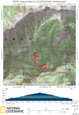
 Thunder Knob trail.

To find The Happy Panther Trail, park at the Ross Dam parking lot alongside Hwy 20. This is also where Hwy 20 is closed on the west side of the North Cascades for the winter. At this time of year there are very few people in the area. Today there were only two other cars in the parking lot.

Follow the trail from the parking lot down toward Ross Dam. This trail crosses Happy Creek (thus the 'happy' in 'Happy Panther'). Once you reach the dam road, turn right and head toward the lake. Turning left would take you to the dam (or beyond to Green Point and Big Beaver campgrounds). A short distance later you'll find the sign for the Happy Panther trail.

Per the sign, it is about 5.25 miles from this point to the East Bank Trail and Hwy 20.


Ross Lake was as smooth as glass. It was incredible. Unbelievable.


Excluding the descent from the parking lot, the Happy Panther trail doesn't do a lot of elevation changes. Instead, it keeps to a relatively flat slope (at least for the first couple of miles that I did).

This first part of the trail was really neat. The trail starts out on a bed of moss growing on some kind of rock before proceeding through a mossy corridor of trees. There is a steep drop off (100 to 300 feet) down to the lake on one side and 100-300 feet of rock cliffs immediately above you on the opposite side of the trail. Watch your step. Bad footing could give you a real scare.


A short distance later you cross a mossy talus slope and then re-enter the forest.


It's quiet. It's very nice.

The drama of the steep drop offs and rock cliffs subside after a while, leaving you to contour with the land in and out of drainages.


After hiking a couple miles out the trail I turned around and visited Ross Lake for a few pictures of blue skies and surrounding peaks before returning to the car.


Somewhere I read that this trail was one of the original routes used by early miners to travel this area. This trail is 'one of the newest and also oldest routes' in the park.

On a related note, there is a book called "The North Cascadians" by JoAnn Roe which I've been reading and it has a lot of neat information and stories about the Ross and Diablo areas. A great read. Check it out.

Total elevation gained: 1,225 feet during 6.5 miles of travel. This is from the parking lot down to the lake, out Happy Panther trail for a ways, back down to Ross dam and then a return to the parking lot.


Only encountered one other person the entire time. This person was heading out for an overnight at Big BeaverCampground on the west side of Ross Lake. Hopefully he had rain gear since, despite the blue sky, it began raining two hours later.

Off to check out Thunder Knob...

Happy Trails!

~E

Friday, February 12, 2010

Itinerary for 02/13/2010

Tentative Itinerary for Saturday, February 13, 2010: Will be heading out the North Cascades Highway (Hwy 20) to Diablo and Ross Lake to visit the Happy Panther Trail and the Thunder Knob trail.

Depending on snow/trail/weather conditions, may stop by other scenic areas along the way such as Diablo, Newhalem or the North Cascade Institute campus. Expect to be back in cell phone range by 6:00pm.

May go searching for Gilligan Falls if I get back in town early enough. Gilligan Falls is located off the South Skagit Highway near Day Creek road.

Happy Trails!

~E